


Voting District 205, Love County, Oklahoma
About
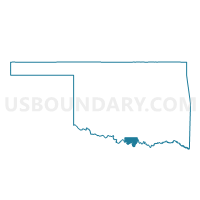
Outline

Summary
| Unique Area Identifier | 654342 |
| Name | Voting District 205 |
| County | Love County |
| State | Oklahoma |
| Area (square miles) | 80.62 |
| Land Area (square miles) | 79.41 |
| Water Area (square miles) | 1.21 |
| % of Land Area | 98.50 |
| % of Water Area | 1.50 |
| Latitude of the Internal Point | 33.98150170 |
| Longtitude of the Internal Point | -97.37190360 |
Maps


Graphs
Select a template below for downloading or customizing gragh for Voting District 205, Love County, Oklahoma


Neighbors
Neighoring Voting District (by Name) Neighboring Voting District on the Map
- Voting District 0033, Cooke County, TX
- Voting District 102, Love County, OK
- Voting District 204, Love County, OK
- Voting District 206, Love County, OK
- Voting District 207, Love County, OK
- Voting District 208, Love County, OK
- Voting District 313, Love County, OK
Top 10 Neighboring County Subdivision (by Population) Neighboring County Subdivision on the Map
- East Love CCD, Love County, OK (7,505)
- Callisburg CCD, Cooke County, TX (5,994)
- West Love CCD, Love County, OK (1,918)
Top 10 Neighboring Unified School District (by Population) Neighboring Unified School District on the Map
- Wilson Public Schools, OK (2,793)
- Turner Public Schools, OK (2,303)
- Sivells Bend Independent School District, TX (533)
Top 10 Neighboring State Legislative District Lower Chamber (by Population) Neighboring State Legislative District Lower Chamber on the Map
Top 10 Neighboring State Legislative District Upper Chamber (by Population) Neighboring State Legislative District Upper Chamber on the Map
Top 10 Neighboring 111th Congressional District (by Population) Neighboring 111th Congressional District on the Map
Top 10 Neighboring Census Tract (by Population) Neighboring Census Tract on the Map
- Census Tract 1, Cooke County, TX (5,892)
- Census Tract 942, Love County, OK (4,640)
- Census Tract 943, Love County, OK (1,918)
Top 10 Neighboring 5-Digit ZIP Code Tabulation Area (by Population) Neighboring 5-Digit ZIP Code Tabulation Area on the Map
- 76240, TX (26,120)
- 73448, OK (5,784)
- 73463, OK (3,501)
- 73430, OK (1,176)
- 73453, OK (661)
- 73441, OK (165)